| HOME | PROTECTION | NATURE | PLAN YOUR VISIT | FAQ | JOIN/DONATE | ABOUT |
|
South Breitenbush Gorge Trail
|
| Difficulty: Easy to Medium Length: 2.5 miles from access #1 to Access # 3 One Way Forest Service site: Breitenbush Gorge William Sullivan [WS 21] gives the length as 3.1 miles one way, 6.2 miles round trip. |
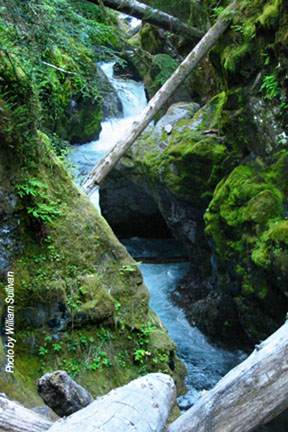 |
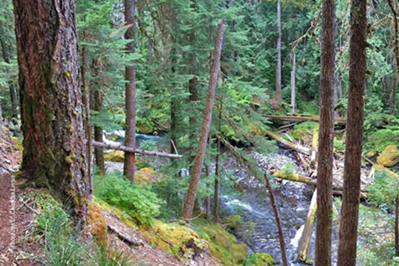 Photo above courtesy of Chandra LeGue. Photo on left courtesy of William Sullivan. |
| If you are looking for your first hike in the Doug, you can't go
wrong on this trail, designated a National Scenic Trail. This trail goes along the South Breitenbush River and gives access to over views of the Gorge. BE CAREFUL near the Gorge . There is limited parking at all the Access points, with the most at Access #3. Access #3 is the access point for the South Breitenbush trail, which leads very quickly into the Mt. Jefferson Wilderness. The Forest Service may expect to see a wilderness permit in a vehicle parked at this trail head. The sight and sound of the South Breitenbush River along with old growth Douglas-fir and Western Hemlock forest settings accompany the hiker along the Gorge Trail. This trail winds along the South Breitenbush River through Douglas-Fir, Western Hemlock, Pacific Yew and Western Red Cedar. The trail has a few wind damaged timber stands, beautiful stream crossings and spectacular plant life. A short scramble over wind blown logs will offer great views of the gorge but the hike from the trail can be treacherous. At the gorge river passes through a 300 foot long basalt narrows. Watch for difficult footing between the main trail and the Gorge viewpoint. At Roaring Creek is the largest bridge of the trail, three other smaller bridges are located east of Roaring Creek. 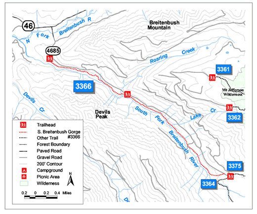 |
| Directions: From Detroit, Oregon turn east onto Breitenbush Road
(Highway 46) (West Cascade Scenic Highway), travel for 11.5 miles to the junction with Forest
Service Road 4685, turn right on FS Road 4685. William Sullivan says that the turn is 11.2 miles along Breitenbush Road. He recommends parking where the Forest Service has Service Road 4685 starting, and hiking in from there. Access #1 is 1/2 mile up FS Road 4685. Access #2 is 2 miles up FS Road 4685 at Roaring Creek. The third access point is the South Breitenbush Trail trailhead - 2 miles past access #2. |