|
|
| HOME | PROTECTION | NATURE | PLAN YOUR VISIT | FAQ | JOIN/DONATE | ABOUT |
| DOIN' THE DOUG - TRAIL GUIDES |
|
Gordon Lakes Trail West
|
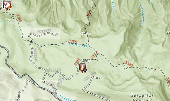
| Length: 7.2 miles Difficulty: Moderate Elevation Gain: 3,000 - 4,100 feet Forest Service Web site (Trail #3386) (titled) Gordon Lakes Trail |
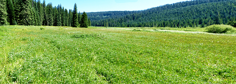
Starting in older harvest units, the trail switchbacks into remnant pockets of old-growth forest. The trail parallels Falls Creek, as it slowly climbs up to Gordon Meadows. Beyond the Meadows, you will pass under Soapgrass Mountain, a sheer basalt cliff, before arriving at two Gordon Lakes containing cutthroat trout. If you are primarily interested in accessing the lakes, you can start at the eastern trailhead. |
|
Directions: This starts the same as the route to the East trail to Gordon Meadows, but changes along Forest Service Road 2032. Turn south off Highway 20 at mile 46 onto Gordon Road (Forest Service Road 2032), 16.6 miles east of Sweet Home. Travel 5 miles and turn left on spur road 325. The trailhead is at the end of the spur. |