|
|
| HOME | PROTECTION | NATURE | PLAN YOUR VISIT | FAQ | JOIN/DONATE | ABOUT |
| DOIN' THE DOUG - TRAIL GUIDES |
|
McQuade Creek Trail
|
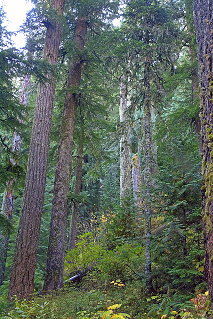 Old-growth forest in the upper reaches of the trail. |
| Length: 5.2 miles Difficulty: Moderate / Difficult Elevation Gain: 2,640 - 4,320 feet Forest Service Trail #3397 Site: McQuade Creek Trail This trail goes into the Middle Santiam Wilderness (permit required) |
| This hike begins in dense, young plantations. It crosses two
creek channels (no bridges). After traversing a fairly recent clear
cut, you enter a mature and old-growth forest, composed mostly of
western Hemlock. Just before the trail connects with the Chimney
Peak Trail at the northern Middle Santiam Wilderness, you may
notice the McQuade Creek Shelter remains. The shelter collapsed in
1996. |
| Directions: From Sweet Home, travel east on Highway 20 for 4 miles
to Quartzville Road and turn left. Travel 32 miles to Forest Road
1142 and turn right. Follow 1142 for 4 miles to the trailhead. The
access road is rough. |