| HOME | PROTECTION | NATURE | PLAN YOUR VISIT | FAQ | JOIN/DONATE | ABOUT |
|
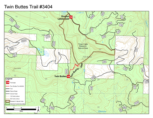
Twin Buttes Trail
|
| Length: 1.2 miles Difficulty: Moderate Elevation Gain: 4,240 - 5,312 feet Forest Service Web site (Trail #3404): Twin Buttes Trail |
The trail winds through mature true fir forests as it climbs to the top of Twin Buttes, an old abandoned lookout site. Views of the Cascades are splendid from this 5,300-foot viewpoint.
|
Directions: Turn south off Highway 20 at mile 46 onto Gordon Road (Forest Service Road 2032). This is 16.6 miles east of the Sweet Home Ranger District office in Sweet Home. Travel 14.4 miles on Gordon Road to the trailhead on the left. |