|
|
| HOME | PROTECTION | NATURE | PLAN YOUR VISIT | FAQ | JOIN/DONATE | ABOUT |
| DOIN' THE DOUG - TRAIL GUIDES |
|
Iron Mountain
|
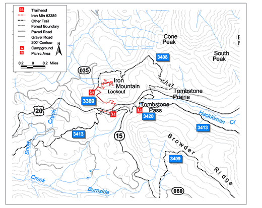
| Length: 1.7 miles Difficulty: Difficult Elevation Gain: 4,000 - 5,455 feet William Sullivan Trail Number [WS 16] Forest Service Trail #3389: Iron Mountain Lower Trailhead: Iron Mountain - Deer Creek (FS Road 15) Trailhead |
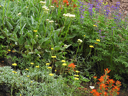
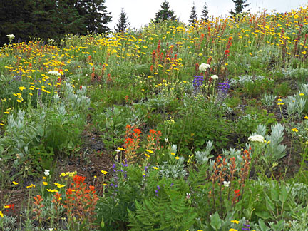
| Iron Mountain is a crown jewel of the proposed Douglas-fir
National Monument. The spectacular wildflower display is one of the
best in the Cascades. Most of the photos in the book Wildflowers
of the Western Cascades come from Iron Mountain. Best time to
go for wildflowers (and butterflies) is in late June through July. Most of the flowers shown elsewhere, on the pages Wildflowers and High Meadows and the Deep Woods were taken on one of the trails to Iron Mountain (including the trail that goes up Cone Peak and then on to Iron Mountain). An interpretive brochure is available at the Iron Mountain Trailhead. |
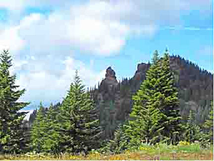
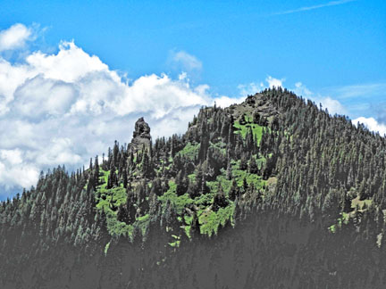
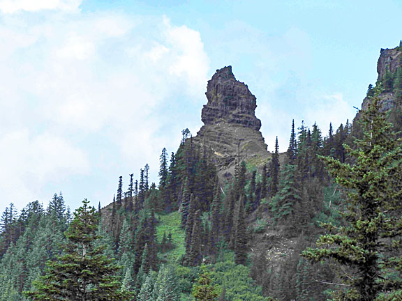
| Iron Mountain is composed of two peaks, one of which has a fire
lookout. The other, lower peak, is a sheer spire. Be careful
climbing the Iron Mountain Trail, especially the final segment near
the summit cliffs. Iron Mountain seen from Cone Peak.
A hiker can see more than 300 species of flowering plants along the trail, in the deep woods and as you pass through the meadows on the Iron Mountain Trail.
|
| Directions: There are several paths to the top of Iron Mountain. The trailhead closest to Highway 20, involves less Forest Road travel and a longer, uphill hike through an old growth section and a hillside meadow. Turn south off Highway 20 at mile 63 onto Deer Creek Rd (Forest Road 15). The parking area for the trailhead is 0.5 miles down the road on the right. A second trailhead requires a longer drive on Forest Roads, but then a shorter hike. Turn north off Highway 20 at mile 61 onto Forest Road 2000-035, also called Civil Road, 32 miles east of Sweet Home, then drive 2.6 miles to the trailhead. A restroom is located at this upper trailhead. This path skips most of the forested part of the trail, and quickly starts up Iron Mountain Peak itself. The trailhead closest to Highway 20, involves less Forest Road travel. Take Highway 20 34 miles east of Sweet Home. Turn right onto Forest Road 15. The parking area for the trailhead is 0.5 miles down the road on the right. You can also get to the Iron Mountain Trail, joining near this higher trailhead by climbing the Cone Peak Trail, and then continuing on the trail on along a ridge to Iron Mountain. William Sullivan recommends this path (past Cone Peak), because it gives a view of the Cone Peak meadows, which contain their own wildflower display. This path takes 8 miles. |