|
|
| HOME | PROTECTION | NATURE | PLAN YOUR VISIT | FAQ | JOIN/DONATE | ABOUT |
| DOIN' THE DOUG - TRAIL GUIDES |
|
Pamelia Lake Trail
|
| Length: 4.4 miles, round trip. Difficulty: Easy 800 feet elevation gain [WS 23] FS trail #3439: Pamelia Lake Trail A wilderness permit is required in the summer, and a special permit is required for this trail, effective May 2021. Information |
This trail includes crystal clear streams, lakes, wildflower
meadows, and rugged mountain views. Pamelia Lake is one of the most
popular hiking destinations in the Mt. Jefferson Wilderness. The
trail meanders along the picturesque Pamelia Creek through
old-growth rain forest-like Douglas fir, Western Hemlock and Western
Red Cedar. From time to time, you will have excellent opportunities
to enjoy the creek and its beautiful cascades and view remnants from
the 2006 Milk Creek landslide. This landslide came from the Milk
Creek glacier on Mt. Jefferson. Just before the lake, you will find
a trail junction. The trail to the right goes to Grizzly
Peak Trail the trail to the left goes to the Pacific Crest
Trail and to the Hunts Cove Trail. The
Lake is straight ahead from the junction. 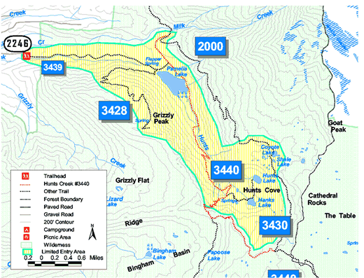
|