|
|
| HOME | PROTECTION | NATURE | PLAN YOUR VISIT | FAQ | JOIN/DONATE | ABOUT |
| DOIN' THE DOUG - TRAIL GUIDES |
|
Rooster Rock Trail
|
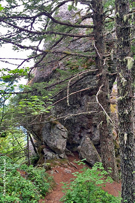
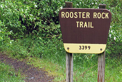 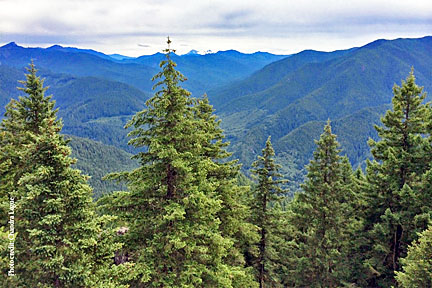 Photo above and to the right courtesy of Chandra LeGue |
 |
| Length: 2.1 miles Difficulty: Moderate / Difficult Elevation Gain: 1,300 - 3,567 feet William Sullivan discusses this as number 112. Forest Service Trail #3399 Site: Rooster Rock This trail goes into the Menagerie Wilderness (Permit Required). |
| This trail starts slowly for 0.9 miles, then rises steeply to
Rooster rock. Rooster Rock is an enormous pillar of andesite and
basalt, popular with rock climbers. BE CAREFUL. There are remains of
an old fire lookout, abandoned in 1963, at the top of Rooster Rock.
This trail is popular with rock climbers. William Sullivan describes this trail as climbing steeply through a forest of madrone. A half mile from the top, the trail joins the Trout Creek Trail, which is a slightly longer, less steep trail through Douglas Fir. William Sullivan says about the trail after joining the Trout Creek Trail: "when the trail forks, ignore the route straight ahead - it's a rough climbers trail to a logging road near Rabbit Ears' twin 260 foot pillars. Take the right hand fork, to a rock knoll that was the base camp for a fire lookout perched atop Rooster Rock's pinnacle." |
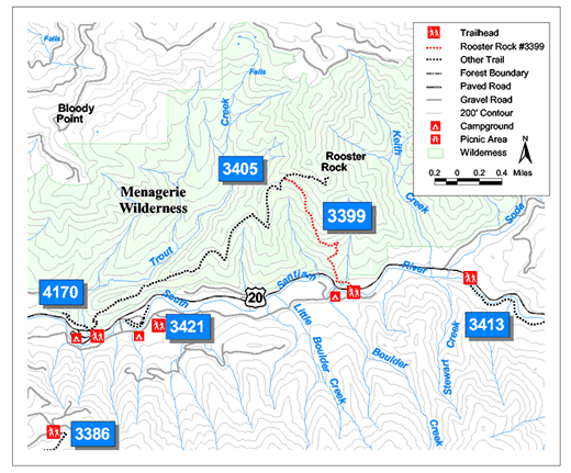
Directions: Turn off the north side of Highway 20 at mile 51.6.
From Sweet Home Ranger District office in Sweet Home this is 22.5
miles east. Parking is available in the area next to the
state highway cinder stockpile. The trailhead is located 0.3 miles
east of the Fernview Campground. |